
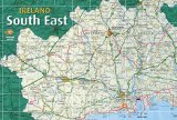
South East Ireland Tourism
Travel guide to Ireland's south east
Travel guide to Ireland's south east
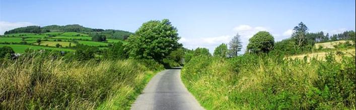
An Rinn (Ring), Waterford
An Rinn (Ring), Waterford
The term Gaeltacht refers to those regions of Ireland in which the Irish language (Gaeilge) is still spoken as a community language, and where Irish culture and tradition are very much alive and thriving. Each region possesses an environment, rich with heritage and folklore, culture and traditions and has a strong sense of its own identity and uniqueness.
In County Waterford there is a small Gaeltacht region known as An Rinn. This small coastal Gaeltacht overlooks Dungarvan Harbour and is approximately six miles from there. It is a world apart - in its welcoming people, its scenery, its seascape and above all its cultural vitality. The love of Irish music, song, dance and language is infectious in An Rinn. A spontaneous desire to share tradition with the visitor can erupt at any time in friendly Ring Hostelry. For hikers or bikers, walkers or bird watchers, Ring and Old Parish are hideaways of cliff top trails, unspoiled beaches, inland drumlins and leafy glens. Add to this a hospitable people, and effervescent culture, and everything that makes the Gaeltacht different is on the doorstep.
An Cuinigear, signposted left, leads to a sand and shingle beach from which a wonderful 5km peninsula stretches into Dungarvan Bay. A great variety of seabirds can be observed along this narrow stretch of land which offers an enchanting and very scenic walk An Coinigéar Walk. Views embrace the full sweep of Dungarvan Bay with the dramatic backdrop of the Comeragh Mountains.
Continue on this narrow road to arrive at the imposing edifice which is Coláiste na Rinne, an Irish Language College which is in operation since 1909. Full term (academic year) and summer courses are run in the language.
Complete the loop on this narrow road to rejoin the main road, turning left. The sign signals Udaras na Gaeltachta, an organisation set up by the government to attract industries and promote employment in Gaeltacht areas of Ireland.
The warning sign on the road is in Irish – AIRE (care/attention) and PAISTI (children). The Meitheal Tra na Rinne Teo sign points towards an oyster bed industry, not open to the public. Follow the sign for Ceann Heilbhic (Helvic Head).
Another sign, left, leads to Criostal na Rinne where high quality, individually designed, hand-crafted crystal giftware is produced. Continue on this road and rejoin the Helvic Head road. The tiny fishing port of Helvic offers a peaceful stop, where above pier, an obelisk commemorates those who lost their lives when the ship Erin’s Hope sank off Helvic Head in 1867. The head beyond the village is wild an gloriously scenic.
<< Return to Waterford page
In County Waterford there is a small Gaeltacht region known as An Rinn. This small coastal Gaeltacht overlooks Dungarvan Harbour and is approximately six miles from there. It is a world apart - in its welcoming people, its scenery, its seascape and above all its cultural vitality. The love of Irish music, song, dance and language is infectious in An Rinn. A spontaneous desire to share tradition with the visitor can erupt at any time in friendly Ring Hostelry. For hikers or bikers, walkers or bird watchers, Ring and Old Parish are hideaways of cliff top trails, unspoiled beaches, inland drumlins and leafy glens. Add to this a hospitable people, and effervescent culture, and everything that makes the Gaeltacht different is on the doorstep.
Things To Do
Leave Dungarvan heading west on the N25 towards Cork. Turn left on the R674, signposted An Rinn (Ring) and continue.An Cuinigear, signposted left, leads to a sand and shingle beach from which a wonderful 5km peninsula stretches into Dungarvan Bay. A great variety of seabirds can be observed along this narrow stretch of land which offers an enchanting and very scenic walk An Coinigéar Walk. Views embrace the full sweep of Dungarvan Bay with the dramatic backdrop of the Comeragh Mountains.
Continue on this narrow road to arrive at the imposing edifice which is Coláiste na Rinne, an Irish Language College which is in operation since 1909. Full term (academic year) and summer courses are run in the language.
Complete the loop on this narrow road to rejoin the main road, turning left. The sign signals Udaras na Gaeltachta, an organisation set up by the government to attract industries and promote employment in Gaeltacht areas of Ireland.
The warning sign on the road is in Irish – AIRE (care/attention) and PAISTI (children). The Meitheal Tra na Rinne Teo sign points towards an oyster bed industry, not open to the public. Follow the sign for Ceann Heilbhic (Helvic Head).
Another sign, left, leads to Criostal na Rinne where high quality, individually designed, hand-crafted crystal giftware is produced. Continue on this road and rejoin the Helvic Head road. The tiny fishing port of Helvic offers a peaceful stop, where above pier, an obelisk commemorates those who lost their lives when the ship Erin’s Hope sank off Helvic Head in 1867. The head beyond the village is wild an gloriously scenic.
An Rinn (Ring) Map
<< Return to Waterford page