
South East Ireland Tourism
Travel guide to Ireland's south east
Travel guide to Ireland's south east
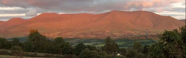
Fethard, Tipperary
Fethard, Tipperary
Fethard comes into prominence with the coming of the Normans to Ireland in the 12th century. Fethard, Fiodh Ard, simply means the ‘high pasture’ or ‘high wood’ and it is a name that could be found in many parts of Ireland. Fethard’s success as a town is due to it’s location, being in the heart of extremely good agricultural land together with having the advantage of being close to the river Clashawley, or Clash Alainn, the ‘lovely stream’. In 1185 the extensive woodlands of South Tipperary, then occupied by the native Irish, were parcelled out to Philip of Worcester. Only twenty-three years later a Norman Lord, almost certainly William de Braose describes Fethard, quite possessively, as “my borough of Fethard”. The Norman town of Fethard was founded during this period.
The Town Hall in Main Street was built c1608. It is one of the largest urban buildings of that period still standing in Ireland with a very distinctive eight-sided chimney pot.
Up to 9th of January 1990, Fethard had four local medieval Sheela-na-gig (sculptured figure dating to 15th or 16th century) carvings. Now three remain, at Kiltinan Castle, Watergate and the Abbey Church.
The circuit of the town wall is virtually complete and these define a flat-oval shaped area enclosing roughly 5.5 hectare or about 13.5 acres.
<< Return to Tipperary page
What to do and see in Fethard
Holy Trinity Church in Main Street is one of the largest and finest medieval parish churches in Ireland. It was originally dedicated to St. John the Baptist, only becoming Holy Trinity Church in the 16th Century. The Nave is 13th century in date, and probably dates back to the time of the town’s foundation. Much of the church interior is still intact and gives a good idea of what a medieval parish church looked like.The Town Hall in Main Street was built c1608. It is one of the largest urban buildings of that period still standing in Ireland with a very distinctive eight-sided chimney pot.
Up to 9th of January 1990, Fethard had four local medieval Sheela-na-gig (sculptured figure dating to 15th or 16th century) carvings. Now three remain, at Kiltinan Castle, Watergate and the Abbey Church.
The circuit of the town wall is virtually complete and these define a flat-oval shaped area enclosing roughly 5.5 hectare or about 13.5 acres.
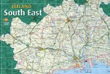
Fethard Map
<< Return to Tipperary page