
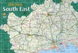
South East Ireland Tourism
Travel guide to Ireland's south east
Travel guide to Ireland's south east
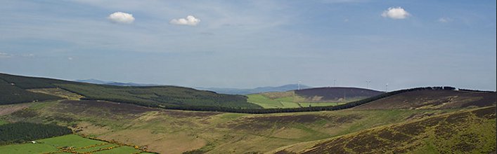
St. Mullins, Carlow
St. Mullins, Carlow
The picturesque village of St. Mullins in South Carlow is a scenic and charming Barrow-side village with an impressive ecclesiastical history. Nestling between the Blackstairs Mountains on one side and Brandon Hill on the other, the locality acquired its name from St. Moling, a 7th century cleric, prince, poet, artist and artisan, who built a monastery here with the help of "Gobban Saor", the legendary Irish builder. In the 8th century manuscript, known as “The Book of Mulling”, there is a plan of the monastery – the earliest known plan of an Irish monastery – which shows four crosses inside and eight crosses outside the circular monastic wall. It is said that St. Moling dug a mile-long watercourse with his own hands to power his mill – a task that took seven years! He became Bishop of Ferns, died in 697 and is buried at St. Mullin’s.
Another notable monument in the packed little churchyard is a penal altar, used in the days when the anti-Catholic penal laws were in force. A Norman motte, once topped by a wooden castle, stands outside the churchyard, and when Mass was being said at the altar some of the congregation would climb the motte to act as lookouts.
The MacMurrough Kavanaghs, former Kings of Leinster, together with other Celtic Kings, are buried in the precincts of the monastery. Fr. Daniel Kavanagh, who is said to have had the gift of healing, is also buried here. People still claim that to cure toothache you should take a pinch of earth from outside the churchyard and exchange it for a pinch of clay from F. Kavanagh's grave. Then say a brief prayer, pop the clay into your mouth and walk down the hill to wash it out with water from St. Molings Well.
The complex includes a medieval church ruin, the base of a round tower and the former Church of Ireland church, built in 1811. Protestants and Catholics lie side by side in the churchyard, and a story is told in the village of the days when, because there were only a handful of Protestants in the neighbourhood, the local Church of Ireland Bishop was thinking of closing down the church. The distraught vicar had a word with the Catholic priest, who had a word with his flock, and on the day of the Bishop’s visit Catholic families filled the Protestant church, joining in the responses and lustily singing Protestant hymns. The Bishop went home delighted and the church remained open!
The church was acquired by St. Mullins Mhuitir na Tire for use as a heritage centre in 1986. All aspects of local history including publications, church records, maps, old photographs and small artefacts are on display here. (A most interesting and informative tour of the settlement is available by contacting 051 - 424913)
As well as being a good spot for anglers, St. Mullins is one of the stop-off points for the many pleasure barges/cruisers who ply the River Barrow. The building of the canal system of lock system on the river began here in 1750.
St. Mullins is also the starting/finishing point of the Barrow Way long distance waymarked way or for visitors who prefer a shorter walk, enjoy the 6Km Sli na Slainte route which commences outside the graveyard, passes through Bahana Wood and returns via Templenabo to the village.
<< Return to Carlow page
What to see and do in St. Mullins
The St. Moling watercourse is still there, but the original monastery was plundered by the Vikings in 951 and was again burned in 1138. An abbey was built on the site later, in the Middle Ages. A 9th century High Cross, depicting the Crucifixion and the Celtic spiral pattern, stands outside the remains of the abbey and there are also some domestic medieval buildings, including one that has an unusual diamond-shaped window. St. Moling's Mill and Well are a short distance away.Another notable monument in the packed little churchyard is a penal altar, used in the days when the anti-Catholic penal laws were in force. A Norman motte, once topped by a wooden castle, stands outside the churchyard, and when Mass was being said at the altar some of the congregation would climb the motte to act as lookouts.
The MacMurrough Kavanaghs, former Kings of Leinster, together with other Celtic Kings, are buried in the precincts of the monastery. Fr. Daniel Kavanagh, who is said to have had the gift of healing, is also buried here. People still claim that to cure toothache you should take a pinch of earth from outside the churchyard and exchange it for a pinch of clay from F. Kavanagh's grave. Then say a brief prayer, pop the clay into your mouth and walk down the hill to wash it out with water from St. Molings Well.
The complex includes a medieval church ruin, the base of a round tower and the former Church of Ireland church, built in 1811. Protestants and Catholics lie side by side in the churchyard, and a story is told in the village of the days when, because there were only a handful of Protestants in the neighbourhood, the local Church of Ireland Bishop was thinking of closing down the church. The distraught vicar had a word with the Catholic priest, who had a word with his flock, and on the day of the Bishop’s visit Catholic families filled the Protestant church, joining in the responses and lustily singing Protestant hymns. The Bishop went home delighted and the church remained open!
The church was acquired by St. Mullins Mhuitir na Tire for use as a heritage centre in 1986. All aspects of local history including publications, church records, maps, old photographs and small artefacts are on display here. (A most interesting and informative tour of the settlement is available by contacting 051 - 424913)
As well as being a good spot for anglers, St. Mullins is one of the stop-off points for the many pleasure barges/cruisers who ply the River Barrow. The building of the canal system of lock system on the river began here in 1750.
St. Mullins is also the starting/finishing point of the Barrow Way long distance waymarked way or for visitors who prefer a shorter walk, enjoy the 6Km Sli na Slainte route which commences outside the graveyard, passes through Bahana Wood and returns via Templenabo to the village.
St. Mullins Map
<< Return to Carlow page