
South East Ireland Tourism
Travel guide to Ireland's south east
Travel guide to Ireland's south east
Dungarvan to Tramore Drive
Dungarvan to Tramore Drive
Dungarvan • Clonea Strand • Stradbally • Bunmahon • Annerstown • Fenor • Tramore •
Follow the Tramore signs from Dungarvan, crossing the Colligan River. Turn right immediately after the next bridge, keeping close to the coast. Dungarvan Golf Club is signposted left at this junction. Continue east to Gold Coast Golf Hotel, which provides a beautifully laid-out 18-hole golf facility at the head of the peninsula, with commanding views over Dungarvan Bay.
Turn left beyond the hotel to continue the drive. At the next T-junction turn left and then turn right at the following T-junction for Clonea Strand, one of Waterford’s EU Blue Flag beaches. This lovely crescent of golden sand is set snugly into the coastline. The views from the beach and the scenic walks along it have contributed to the popularity of Clonea over the years.
Keeping Clonea Strand Hotel on the right, head north to the R675 (Dungarvan-Tramore road), turning right for Tramore. The road passes Ballyvoile Cove, with its nearby sandy beach, and then bridges the valleys of the Dalligan and Tay rivers before reaching a junction, right, signposted Stradbally. Turn here.
Stradbally is a picturesque village of neat thatched and slated cottages. it has numerous awards in the National Tidy Towns Competition and was the recipient of a Heritage Award in the prestigious international Entente Florale. The many trees planted by the Fitzgeralds in the 18th century, give the area an unusual tamed sylvan character which contrasts with the wild stretches of windswept coast to come.
Follow the road to Bunmahon, stopping on the way to admire the sea stack formation and islands of Ballydowane Cove (signposted Bally Dwan Strand).
Bunhamon’s lovely beach can be accessed from the centre of the village by foot or from the car park immediately east of the village. Headlands protect the beach at each end and there is an exhilarating walk across the west end cliffs which reveals a superb panorama. As well as intimate coves and dramatic sea stacks. The village is pleasantly laid out and enjoys a tranquil seaside setting. This was not always the case, however, as Bunmahon was the centre of a thriving industry in the last century. Copper was extensively mined in the area between 1824 and 1877. in the early 1840s more than 1,000 people laboured underground.
On the drive east, and visible from the village, is the ruin of the Cornish engine house at Tankardstown. This engine once pumped the mines to a depth of 400m.
Continue eastwards on the Tramore/Coast road, passing three lay-by/picnic areas on the right. The first is at sea level at Kilmurrin Cove, while the other two are higher up and further east towards Dunabrattin Head.
At the apex of the road is Waterford Woodcraft where Bruce and Heather Macdonald have both practised woodturning for over 25 years. The decorative and functional pieces for the home are sculpted from native Irish timbers, such as yew, ash, elm and bog oak. Their shop also displays a range of other Irish crafts.
Immediately east of the shop as the road descents is the pier at Boatstrand. There is access from here via a lovely cliff walk, to the promontory fort on Dunabrattin Head. The views from the Head are truly spectacular and the visitor will get a real sense of formidable defences presented to would-be attackers from this Iron-Age fortifications
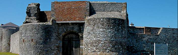
Annestown, the next port of call, presents a pretty picture from the approach road. At the bottom of the hill Annestown Stream (or Anne River) passes under the road. Stop here to admire the reed beds and meandering stream, which is part of an ecological conservation effort in the area. Look north, upstream, to enjoy a wonderful view of Dunhill Castle, perched on a cliff above the river. Drive or walk to the ruin, which was a 13th century Power stronghold. About 1km north and south of Dunhill Village, are two megalithic tombs.
Continue on the coast road the short distance to Annestown car park. The beach, with its castellated lime kiln, sea arch and island, is most attractive and is popular with surfers as well as bathers. To the west of the beach is another promontory fort.
Continue towards Tramore, passing through the village of Fenor. The local church is by Doolin and was built in 1894. Approx. 2km north of the village is another National Monument, Matthewstown Gallery Grave, a fine example of a wedge-shaped tomb dating from c. 2,000 B.C.
Return to the main coats road. East of Fenor, a narrow road, right, leads to Kilfarrasy. The picturesque islands and sea stacks add visual excitement to this secluded cove and beach. The headland east of the beach contains the remains of a promontory fort. Return to the main road and travel east to Tramore.
Tramore Golf Club is signposted, left on the western approaches to the town. The signs for Newtown Cove and the Doneraile walk are also here; both are described under Tramore.