
South East Ireland Tourism
Travel guide to Ireland's south east
Travel guide to Ireland's south east
Lismore & The Vee Drive
Lismore & The Vee Drive
Lismore • The Vee • Clogheen • Goatenbridge • Newcastle • Mount Melleray • Cappoquin • Lismore •
A spectacularly beautiful drive, where the scenery climbs and dips and changes constantly to delight the eye at every turn in the road.
Leave Lismore via the Clogheen Road. The road rises through beautifully wooded countryside along the river valley. The landscape then opens up offering a variety of textures and colours, including peatland, rocky headlands, rhododendron groves and blanket heather. A viewpoint, left, presents lovely mountain views. Soon after, the road reaches its apex at The Vee.
If this glorious panorama was presented in a 19th century painting, it would be considered highly romantic and even overstated. But these wonderful Knockmealdown Mountains are the stuff of romance and all the visitor can do is stop, stare and enjoy. After the exhilarating wilderness left behind, the hills fall away in great folds to reveal the Golden Vale below. The Tipperary plains are so called because of the rich grazing land which produces fine mild cows for Ireland’s dairy industry. The Cyclopean tomb just above the viewpoint marks the grave of Samuel Richard Grubb, High Sheriff of County Tipperary, who, it is said, wished to be buried in a standing position, so that his sightless eyes could be directed over his beloved Vee.
Continue the tour, where another viewpoint presents a different perspective on the landscape, with lovely Bay Lough, caught by a coum across the valley.
Descend through a series of hairpin bends, to Kilballyboy Wood, right. This beautifully situated park, below the Vee is managed by Coillte and is chiefly planted with Scots pine, Sitka spruce and Douglas fir. Spanish chestnut, Corsican pine, rowan, larch, beech, oak, lodgepole also feature, providing cover for the deer, badger, stoat, mink, squirrel, rabbit and hare. The forest trail is 3km long and there is a car park off the road.
Continue to Clogheen, a pleasant village in beautiful surroundings with attractive sandstone buildings. The Blackwater Way Walking Trail starts in the village and runs for 188km to Killarney, Co Kerry.
On the Clonmel Road, (1km), just after the bridge over the renowned game angling fishery, the River Tar, is Parsons Green Park and Pet Farm. Return to the Vee Road and turn left, signposted Newcastle. Bay-Lough Farmhouse Cheese is signposted right.
At the village of Goatenbridge, a riverside viewpoint presents a beautiful view of the River Tar and the picturesque Goatsbridge, a 5-arch old stone bridge. A village water pump, right, is a reminder of past drudgery and the luxury we now take for granted, running water on tap.
Continue towards Newcastle. The sign approaching the village welcomes travellers and proclaims that the people of Newcastle speak Irish. There is a ruin of a castle and a manorial church in the village, while 2km to the north-east at Moloughnewtown is the ruin of a nunnery, Mollough Abbey founded in the 6th century and dedicated to St. Brigid. Return to the outskirts of Newcastle on the Clogheen road and turn left, signposted Mount Mellary 7 miles (11km).
This road forms part of the East Munster Way for about 4km, before that walking trail turns over the flanks of Crohan West Mountain, right. The drive is now following the old Cappoquin road and the quality of the landscape will prompt many stops to savour the peace and beauty all around. The Monastery sign, right, signals the entrance to Mount Melleray. The Cistercians live to the rule of St. Benedict in the strict form written down by St. Stephen, (Stephen Harding) at Citeaux in France nearly 900 years ago.
They came to Cappoquin from Rathmore in Kerry in the early 1830s with about a dozen monks and grew to a community of 140 in the 1950s. Declining vocations have taken their toll and the community now number 45. Visitors are asked to respect the sanctity of the place. Those who wish to take time for contemplation can stay in the guesthouse on the grounds or the nearby Pilgrims Rest Hotel.
Nearer Cappoquin, on the roadside, right, is a grotto where, it is said the Virgin Mary appeared to two young boys.
The Glenshelane River Walk is signposted here. This river rises south of Newcastle, on the slopes of Knocknasculloge and runs parallel to the road just travelled, about 2-3km to the east. Having being boosted from the waters of the Monavugga and Glenafallia rivers, it joins its bigger sister, the Blackwater, just below Cappoquin. The 10km walk starts just outside Cappoquin and can be accessed here and at other points along its route.
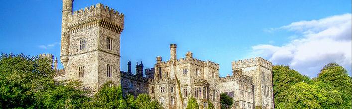
Cappoquin is at the top of the tidal waters of the Blackwater and is a renowned angling centre for both the game and coarse angler. Cappoquin House, in the centre of the town, is an 18th century Georgian mansion built on the site of an old Fitzgerald castle. The house and gardens enjoy magnificent views over the Blackwater, just where this great river bends at an angle of 90%.
Continue to Lismore and the end of the drive, admiring the stretches of the Blackwater which come into view along the road.